Technical Standards & Architectural Imaging FAQ
High-precision documentation for architects, developers, and the Chicago construction industry.
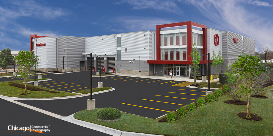
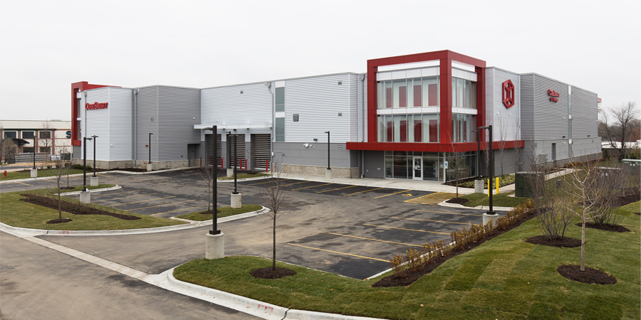
Digital Site Remediation & Post-Production
We treat every raw capture as a foundation. Use the slider to see how we refine geometry and remove environmental distractions to reveal the architect's true intent.
What defines high-level Architectural Imaging?
True architectural photography is a technical discipline focused on the accurate representation of the built environment. We prioritize perfect geometric alignment and "verticality," ensuring every structural line is mathematically straight and true to the original blueprints.
How do you handle environmental imperfections on-site?
Using advanced digital remediation, we remove permanent distractions that compromise a design—such as fire safety equipment, HVAC sensors, or utility lines—allowing the viewer to focus entirely on the materials, flow, and form of the space.
What is the protocol for active commercial locations?
We specialize in "low-impact" production. For operational corporate or industrial sites in the Chicagoland region, we coordinate to capture optimal lighting windows while ensuring your staff and business operations remain undisturbed.
How does the Synergy Licensing (Cost-Sharing) model work?
Large-scale projects are collaborative. Our cost-sharing model allows architects, GCs, and developers to pool resources, ensuring every stakeholder receives a full suite of high-resolution assets and usage licenses at a significantly reduced individual investment.
What are the parameters of your commercial usage licenses?
We provide a comprehensive Commercial Usage License covering industry award submissions, high-end portfolios, and digital/print advertising. Extended licensing is available for third-party material manufacturers or national publications.
Can you document large-scale industrial elevations?
Yes. We utilize specialized high-vantage equipment to capture expansive facades and massive industrial footprints that are impossible to document from ground level, preserving scale without the distorting "keystone" effect.